You can admire the most representative of the Taiwan coastline in Northeast and Yi-lan Coast National Scenic Area.
東北角和宜蘭海岸國家風景區,可以欣賞到台灣最有代表性的海岸線。
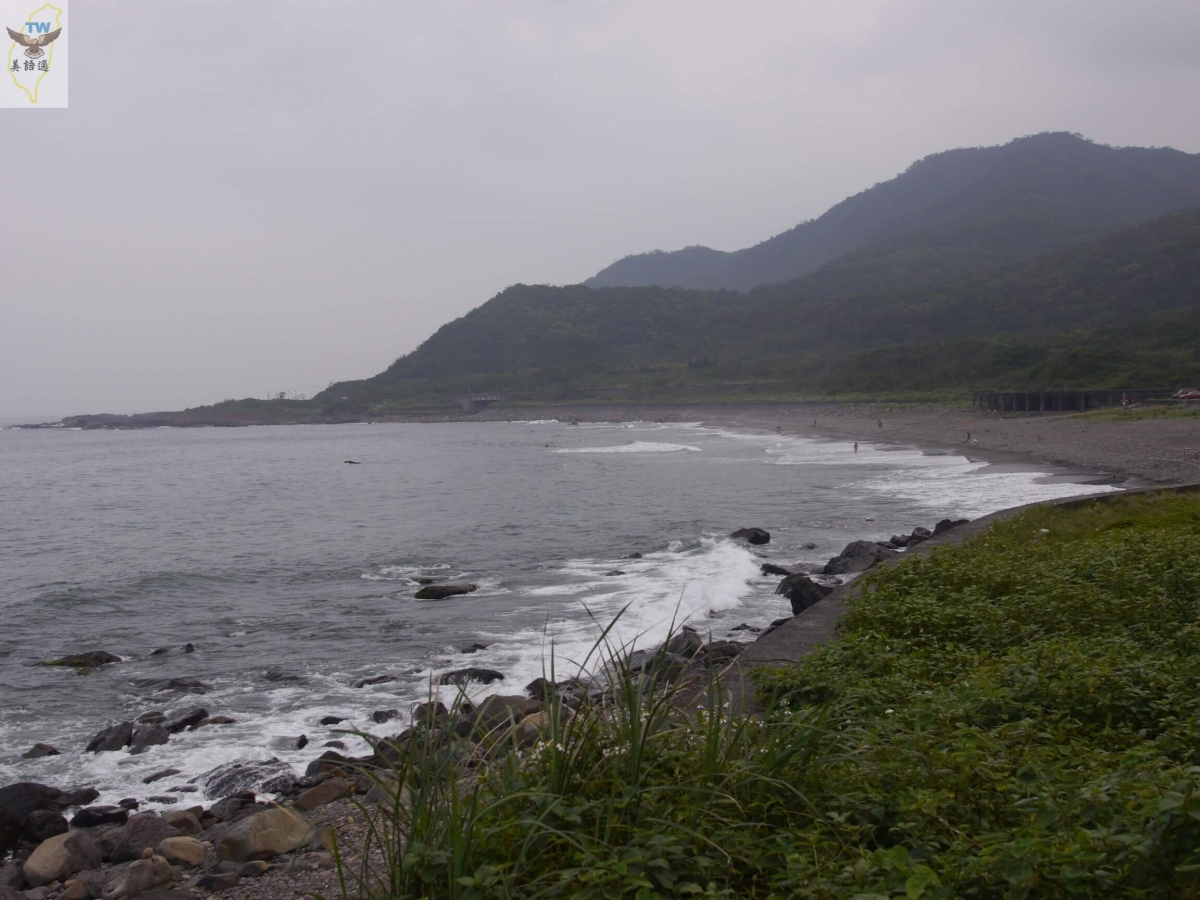
With rocky terrain formed by the ancient settlement, Northeast Coast is among the most distinctive coasts in Taiwan. It became a national scenic area in Taiwan in 1984. The scenic area has encompassed the thirty some kilometers of Yi-lan coast since 2007, continuing to be the only unexploited sandy coast in Taiwan.
東北角擁有古老沈降岩石地形,是台灣最有特色的海岸之一,1984年成為台灣的國家風景區,2007年納入長達30多公里宜蘭海岸,仍是台灣惟一未受開發破壞的砂質海岸。
There is a local proverb "the head of the wind and the tail of the water," describing a place situated in an area with unfavorable natural resources. The head of the wind means "terrain receiving direct blows from strong winds," and the tail of the water means "the end of a river."
台灣有句地方諺語「風頭水尾」,形容一個地方位在自然資源很不利的地區。風頭的意思是,指直接受到強風吹襲的地形,水尾則是河流的最末端。
Northeast Coast has always been "the head of the wind" of Formosa Island. The rocky coasts and sedimentary environment eaten away by the pounding waves and blown by the 6-month-long northeast monsoon are perhaps the harshest areas while presenting the matchless scenery.
東北角一直是台灣島的「風頭」。岩石海岸和沈降的地形,海浪拍打侵蝕,伴隨半年的東北季風吹襲,也許是最嚴厲的區域,同時也呈獻了無比的風景。
The Northern Coast Highway, which used to be the only way to get to Northeast Coast, is one of the main roads to Yi-lan.
以前到東北角走的維一一條北部濱海公路,是到宜蘭主要道路之一。
The coastal highway is quite long, requiring you to go through the heavy traffic in the bustling Keelung area. There is sometimes a danger of falling rocks due to the terrain by the highway.
濱海公路很漫長,沿途要經過基隆市鬧區的重重車陣,公路旁的地形,有時會有危險的落石。
Although there are numerous types of gorgeous scenery, it's a very distant journey. You can further experience "the head of the wind" when the northeast monsoon blows during winter.
雖然美景很多,路程相當遙遠,冬天東北季風吹襲,你更可以體驗到風頭的意思。
Since Shue-shan Tunnel on National Highway 5 and Wan-rui Expressway became opened to traffic, the journey to Northeast Coast has shortened significantly.
國道5號雪山隧道和萬瑞快速道路通車,到東北角路程縮短很多。
Coming from Toucheng Interchange, you can head in the opposite direction from Jiaoxi to connect to Northern Coast Highway.
從頭城交流道下來,往礁溪相反方向,接上北部濱海公路。
As long as there are no traffic jams heading north from south in Shue-shan Tunnel, you can leisurely pick one of the many scenic spots along the way. They all afford the indulgence in the most distinguished scenery of this coastal part of Taiwan.
只要雪山隧道不塞車,由南往北走,沿路有很多景點,輕鬆挑選一個地方,都可以享受到台灣這段海岸,最獨特的景色。
Lan-yang Museum
蘭陽博物館
You'll first arrive at Lan-yang Museum.
首先你會遇到蘭陽博物館。

Lan-yang Museum has a rather uncommon appearance, looking almost like a semi-collapsed building. It actually imitates the terrain of Yi-lan, which features the unique cuesta. The museum utilizes wax statues and numerous medias to bring the history of Yi-lan to life.
蘭陽博物館外形很奇怪,好像半倒的大樓,這實際上是模擬宜蘭地區,也是最有特色的「單面山」,館中也用臘像和多媒體來給宜蘭的歷史帶來些活力。

Lan-yang museum was initially a territorial sea of Wu-shi Port. This part of the coast was named Santa Catalina when the Spanish occupied Su-au Harbor in 1624.
蘭陽博物館原本是烏石港的水域,1624年西班牙人佔領蘇澳港,這一帶海岸被命名為「Santa Catalina」。
It was the largest harbor in Yi-lan during the Qing Dynasty. The Han Chinese entering the Yi-lan Plain for land reclamation had a violent clash with the local aboriginal people in order to claim sovereignty of this place in the 18th century.
清帝國時代是宜蘭第一大港,18世紀進入蘭陽平原開墾的漢人,為了爭奪這裡,和原住民發生激烈衝擊。
In addition to sedimentation, a United States vessel ran aground at the harbor in 1883, causing the harbor to lose its function.
1883年一艘美國船在港口觸礁,加上泥沙淤積,造成港口失去功能。
Wu-shi Port
烏石港
The new Wu-shi Port with a visitor center is situated east of the original harbor. You can board a ship to put out to sea for whale watching. Wu-shi Port, Audi Port and Nan-fang-ao Port are the three major whale-watching ports in Taiwan.
新的烏石港在原來港口東邊,有遊客中心,可以在這裡搭船出海賞鯨,與澳底和南方澳是台灣東北角三大賞鯨港。
Further north is the Wai-ao Beach. It faces and feels very close to the Gui-shan Island. This is a newly established bathing beach. You almost get an illusion of holding the entire island in your arms sitting on the beach!
再往北走是外澳沙灘,正對著龜山島,感覺距離很近,這是新興的海水浴場,坐在沙灘,會有整座島抱在懷裡的錯覺!

The service area is also in the shape of a cuesta, and the bright yellow building is quite appealing. You can get a view of the entire Gui-shan Island from the front entrance in good weather.
服務區也是單面山造型,鮮黃色的建築非常吸引目光,天氣好的時候,從大門口就可以看見整座龜山島。

Wai-ao Beach is where the Yi-lan Rain Festival is hosted. Along with Daxi Honeymoon Bay a bit further north, it's a holy land of surfing. There has been an influx of tourists every summer in the past 10 years.
外澳海灘也是宜蘭「蘭雨節」舉辦的地方,和再往北一點的大溪蜜月灣,都是衝浪聖地,最近十年,每逢夏天這裡是人山人海。


Bei-guan Tidal Park
北關海潮公園
Once you pass Geng-fang Fishery Harbor, you'll arrive at Bei-guan Tidal Park.
過了梗枋漁港後,你會遇到北關海潮公園。

Bei-guan in Chinese means "north tollgate." During the Qing Dynasty, there were two batteries deployed here protecting the fishery harbor.
[Bei-guan]中文就是北關。清帝國時代,這裡部署兩座砲台保護漁港。
With waves crashing against the reeves, the scenery in Bei-guan is spetacular. It forms various types of odd terrain. This is one of the Eight Scenes of Yi-lan.
北關的風景非常特別,礁石和海浪互相衝擊,造成各種奇怪地形,這是宜蘭八景之一。

Perhaps the most special part is that you get to view the Gui-shan Island from afar when you walk into the park. You also get to see and enjoy numerous types of terrain of marine abrasion, including Chessboard Rock, One Line Sky and more.
最特別的是,走進公園,你可以眺望遠方的龜山島,而且可以走進觀賞各種海蝕地形,包括豆腐岩和一線天等。

Honey Moon Bay
蜜月灣
After passing by Daxi Fishery Port, you'll see the Honey Moon Bay. Initially a very remote fishing village, it became sort of like Kenting or Southern California due to the tourists coming to surf and splash around.
過了大溪漁港,你就可以看到蜜月灣。原本很偏僻的漁村,因為衝浪客和戲水的遊客到來,變得好像墾丁或者是加州南部一樣。


You'll suddenly see eye-catching surf shop signs amongst the old Taiwanese tile-roofed houses and concrete townhouses. The mingling between the tradition and modernity is quite special.
在台灣式古老的瓦房和水泥透天厝之間,忽然看到亮眼的衝浪店招,傳統和新潮合而為一,相當特別。
You must not go too fast driving on this highway lest you miss the historic trail and the entrances to gorgeous scenery.
開在這條公路,速度一定不要太快,因為古道或者美景的出入口,一下子就會錯過。
Qing-yun Temple
慶雲宮
For instance, the Dali Tian-gong Temple, also known as Qing-yun Temple, is the entrance to a segment of the Caoling Historic Trail. Once you get to the ridge from here, head north to arrive in Gong-liao and experience the feeling of coming to Yi-lan from Taipei using the only mountain trail 300 years ago.
例如大里天公廟,也就是慶雲宮,是草嶺古道其中一段的入口,從這裡登上稜線後,可以往北到貢寮,體會三百年前台北來到宜蘭,惟一山中步道的感覺。


Alternatively, you can head south to arrive in Daxi and observe the magnificent coastal scenery in Yi-lan from Tao-yuan Valley aloft.
或者你也可以往南走到大溪,從桃源谷高處,看宜蘭海岸壯麗的景觀。

Shih-cheng Service Area
石城服務區
There are many places on the coastal highway that allow you to admire Gui-shan Island from different perspectives; one of them is Shih-cheng Service Area, which is a little place packed with tourists during holidays.
濱海公路很多地方,從不同角度可以欣賞龜山島,其中一個是石城服務區,小小地方假日擠滿了遊客。

Old Caoling Circle Line Bikeway
舊草嶺環狀自行車道
Heading north from here, you will be leaving Yi-lan and entering Great Taipei. The recently opened Old Caoling Circle Line Bikeway brims with allure.
從這裡往北就離開宜蘭,進入大台北地區。最近開闢了,舊草嶺環狀自行車道,風景非常美。


This round bikeway starts at Fu-long, New Taipei City. Riding to Yi-lan from the Great Taipei border, You can enjoy the mountain and sea scenery along the way.
這個環狀自行車道起點在新北市的福隆,從大台北的邊緣,騎到宜蘭,有山景有海景,沿途非常漂亮。

San-diao-jiao Lighthouse
三貂角燈塔
The bikeway is by the coastal highway. When you are about to arrive at San-diao-jiao Lighthouse, pay special attention to every upland as there is a white scenic overlook.
自行車道就在濱海公路旁邊,快到三貂角燈塔,特別注意海邊一個高地,上面有個白色觀景台。


This scenic overlook is right beneath San-diao-jiao Lighthouse, allowing you to look at the ocean ahead and observe sunrise. We happened to catch the beautiful scenery right before the sunset.
這個觀景台,就在三貂角燈角下方,你可以看前方的大海,也可以看日出,我們看到的時候,剛好遇到夕陽下山的美景。


San-diao-jiao was initially named San Diego by the Spanish occupying Taiwan during the 17th century. The Chinese name was renamed San-diao-jiao to sound more Taiwanese.
三貂角是17世紀佔領台灣的西班牙人命名的,原來名字叫SanDiego,中文改成較有台灣味的「三貂角」。
If time allows on your way north toward Fu-long Beach, taking an uphill route will afford frequent encounters with alluring scenic spots.
再往北走往福隆海灘途中,你如果有時間,挑一條山路走上去,常會遇到很美麗的景點。
Ling Jiou Mountain Wu Sheng Monastery
靈鷲山無生道場
Take Ling Jiou Mountain Wu Sheng Monastery for example, it's extremely breathtaking to look at the ocean from the hillside.
例如靈鷲山無生道場,從山腰看海,非常美麗。
Fu-long Beach
福隆海水浴場
Fu-long is the most bustling town along the highway, and the Fu-long Beach is right where you enter the administration office.
福隆是公路沿線最熱鬧的城鎮,從管理處走進去就是福隆沙灘。
Spanning over 3 kilometers, Fu-long beach is the most famous bathing beach in northern Taiwan.
福隆沙灘長3公里多,也是北台灣最有名的海水浴場。
There are Sand Art and various water activities during the peak tourist season in July every year, making it very bustling.
每年七月是觀光熱季,有沙雕和各種水上活動,非常熱鬧。
There is a 4-star hotel with villas next to the ticket window. The rooms facing the ocean all have a balcony offering fantastic scenery.
在收票口旁,有一家4星級飯店,同時擁有別墅區及旅館區,面海的房間,都有陽台,風景非常棒。
There are also many homestays on Fu-long Street. Coming here, don't forget to try the famous Fu-long Bento Box.
福隆街上也有很多民宿,來到這裡不要忘記嚐嚐知名的福隆便當。
Dragon Cave
龍洞
Continuing north, you'll arrive at Dragon Cave after passing by Yan-liao and the sealed Nuclear Plant No. 4. There are a seawater pool and connected yacht harbor on the south side.
再往北,經過鹽寮和封存的核四廠後,會抵達龍洞,南邊有海水游泳池,以及連在一起的遊艇港。

This was the very first yacht harbor in Taiwan, allowing for accommodation of 76 ships.
這是台灣第一座遊艇港,可容納76艘船。
Xiling Yansi
西靈巖寺
Continuing a bit further north, you can view the south Dragon Cave scenery from afar at the Xiling Yansi parking lot.
再往北走一點,可以從西靈巖寺停車場,眺望龍洞地區的南邊景色。

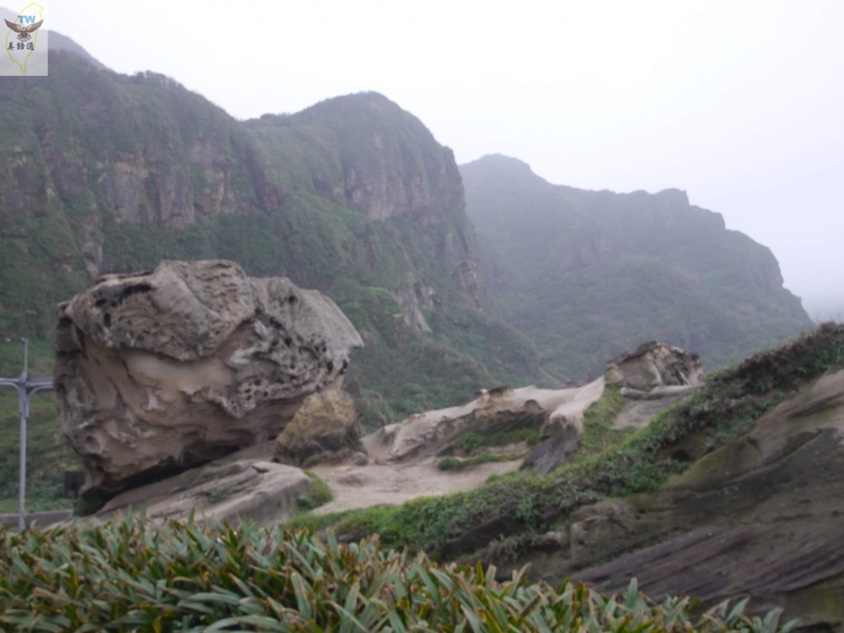
The terrain of Dragon Cave stretches long like a dragon and affords places for rock climbing and diving, making it a great spot for oceanic leisure. There are two seawater pools transformed from the old abalone-breeding ponds.
龍洞因為地形長得像條龍,是海洋休閒好地方,有攀岩場,也是潛水的地方。一共有兩座海水游泳池,都是以前養殖九孔的池子改成。
The south pool is larger; the north one is situated behind reeves, allowing you to enjoy the thrill of huge waves pounding the shore.
南邊泳池較大;北邊泳位在礁岩後方,可以享受大浪拍岸的刺激。
Bee-toe Cape Park
鼻頭角公園
There is Bee-toe Cape Park between Dragon Cave and Nan-ya Rock Formations. The scenery is amazing, and you can spend 3 hours strolling around.
在龍洞和南雅奇岩之間,有一個鼻頭角公園,風景很漂亮,可以上去花個3小時走一走。
Nan-ya Rock Formations
南雅奇岩
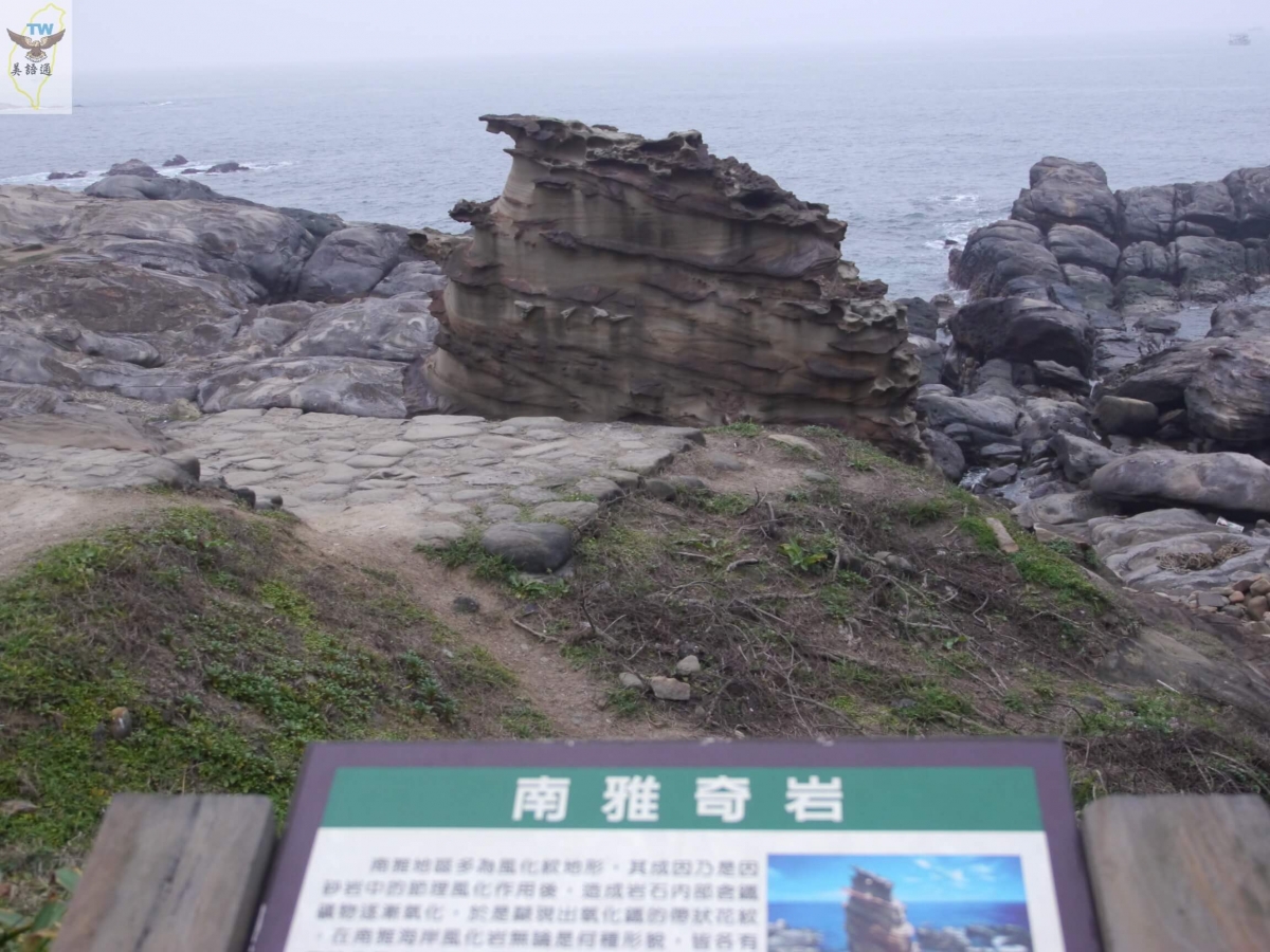
Continue going north, and the Nan-ya Rock Formations is a must-stop. Situated at the coast beneath the 81st highway kilometer stone, it has an entire field of uncannily shaped rocks. One of them closely resembles ice cream!
再往北,南雅奇岩這個地方一定要停下來,位在81公里的公路下方的海岸,有一整片奇岩,其中有一個酷似冰淇淋!


This is the result of many years of strong winds and waves, rendering only the sturdiest land substance to remain. There is also a trail on the other side of the highway, allowing you to climb to a higher position to admire the sea scenery.
這是多年來的風雨和海浪吹襲,留下最堅固的地質。公路另一邊還有步道,可以登上較高處欣賞海景。


池池(07 Nov 2020 - 16:31)
You must enjoy the splendid northeast coastal lines in Taiwan.